Maps & Directions
Maps and Directions
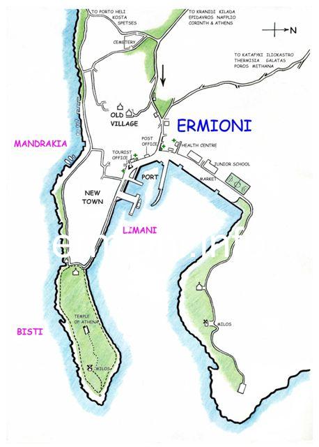
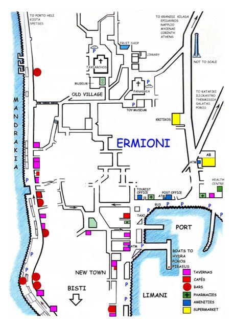
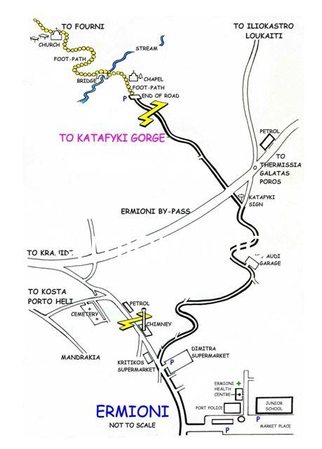
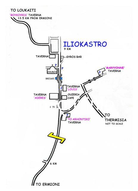
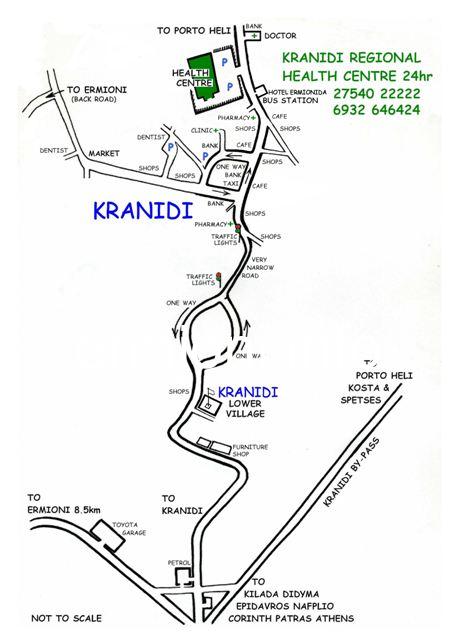
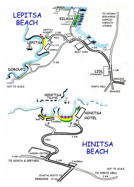
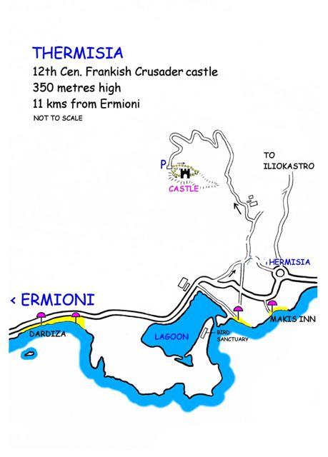
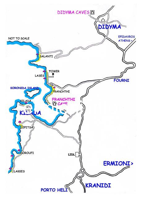
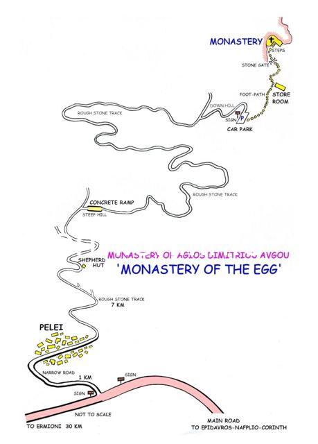
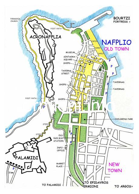
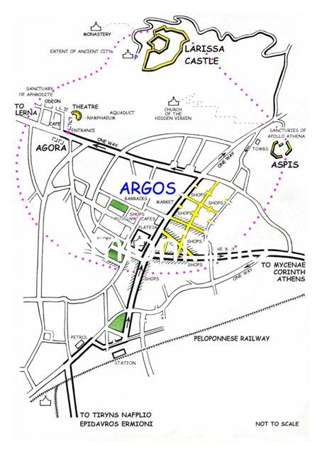
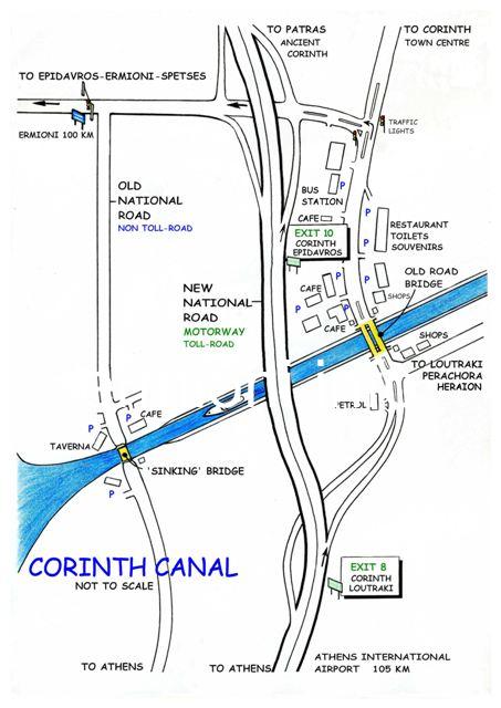
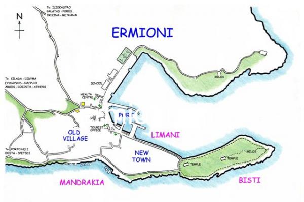
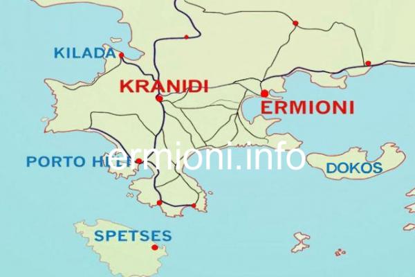
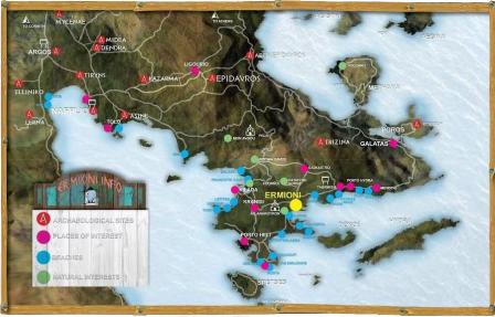 Most people visiting Ermioni and the surrounding areas, will probably use satellite navigation systems or detailed road maps of the region. However, some of these road maps are not always accurate and in some cases the destinations required are not always shown. Therefore, in the picture gallery are a few 'hand-drawn' directional maps, which the visitor might find useful when exploring interesting areas around Ermioni and Ermionida, as well as Nafplio, Argos and the Corinth Canal.
Location
Ermioni
Ermionida Argolida Peloponnese
Greece
37° 23' 8.2428" N, 23° 14' 52.5048" E
Picture Gallery

.jpg)